












The convergence of traditional energy security and emerging green infrastructure across the Arabian Gulf is reshaping subsurface engineering, driving demand for high-precision geo-data to mitigate complex operational risks.
By leveraging non-invasive geophysics, digital analytics, and uncrewed survey technology, Fugro provides NOCs and developers with critical subsurface insights required to safely execute complex offshore field developments while accelerating regional decarbonisation goals.
The company is expanding deployment of uncrewed surface vessels paired with shore-based Remote Operations Centres.
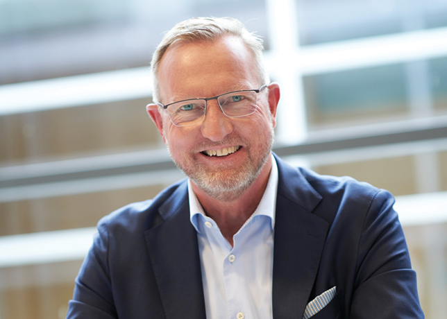
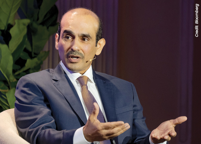
In an exclusive interview with OGN energy magazine, George Ritchie, Country Manager – Marine, Fugro - Saudi Arabia, says: “Depending on the survey scope, remote and uncrewed operations can significantly reduce (up to 90 per cent) fuel consumption and associated emissions compared with conventional offshore survey methods.”
Simultaneously, Fugro is deepening its operational footprint within Saudi Arabia through technical knowledge transfer, local engineering development, and specialised survey hubs in Dammam.
Below are excerpts from the interview:
How is Fugro balancing its capital allocation between expanding traditional offshore oil and gas survey commitments for regional NOCs and investing in site characterisation for emerging green hydrogen and offshore renewable infrastructure across the Arabian Gulf?
Fugro does not see traditional energy and new energy as competing priorities. Both require reliable geo-data to support safe, efficient and sustainable development.
Across the Arabian Gulf, we continue to support national oil companies (NOCs) with site characterisation, asset integrity and offshore surveys that underpin energy security.
At the same time, many of the same capabilities are being applied to emerging infrastructure such as hydrogen projects, subsea power cables and offshore renewables.
Our focus is, therefore, on investing in technologies (like EOMAP) and expertise that serve the entire energy landscape.
By combining advanced geo-data, digital solutions and remote operations, we help clients reduce uncertainty and make informed decisions across both current and future energy systems.
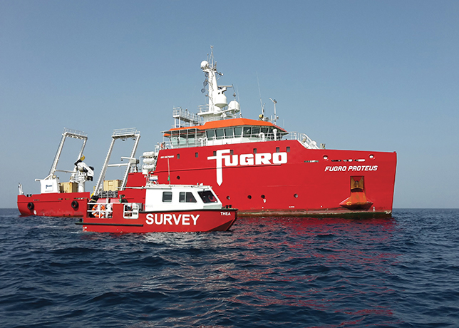
Fugro Proteus and daughter craft Thea ... dedicated fully-equipped geophysical vessel working in the GCC
What specific subsea operational risks are your advanced geotechnical solutions, such as GroundIQ®, mitigating during the front-end engineering design (FEED) stages of complex offshore field developments in Gulf waters?
Complex field developments in Gulf waters face intricate subsurface conditions, from soft marine clays to variable carbonate soils.
GroundIQ® addresses these challenges early in the FEED stage by integrating non-invasive geophysical data with targeted geotechnical sampling and digital analytics.
By unifying subsurface datasets into a single model before design is finalised, we can drastically reduce uncertainty.
This gives engineering teams the certainty needed to optimise foundation designs for platform jackets, rigs, and pipelines, preventing costly over-engineering while drastically reducing the risk of foundation instability or seabed failure during construction.
Given Saudi Arabia’s stringent In-Kingdom Total Value Add (IKTVA) programme and regional localisation mandates, what concrete milestones has Fugro achieved in transferring specialised geo-data technology and technical training to local Saudi personnel?
Having lived and worked in Saudi Arabia for more than two years, I have seen first-hand the ambition behind Vision 2030 and the focus on developing local capability.
For Fugro, localisation is not simply a requirement, it is a long-term commitment.
Through Fugro-Suhaimi and our new dedicated marine survey operations entity, Fugro Marine Survey Company, in Dammam, we are investing in Saudi talent, technology and expertise.
Our focus is on developing local engineers, hydrographers and geoscientists through training, hands-on project experience and knowledge-sharing programmes.
By bringing advanced geo-data acquisition, testing and data processing capabilities into the Kingdom, we are helping build the next generation of Saudi expertise while supporting the continued growth of the country’s energy and maritime sectors.
-and-jack-up-barge-Geo-Giant-in-operations-in-Saudi-Arabia.jpg)
The ROV (left) and jack-up barge Geo Giant in operation in Saudi Arabia
How are your uncrewed surface vessels (USVs) and remote operation technologies delivering tangible reductions in offshore personnel exposure and operational carbon footprints across busy Arabian Gulf maritime lanes?
Remote and autonomous technologies are transforming how offshore data is acquired.
By combining uncrewed surface vessels (USVs) with Fugro’s Remote Operations Centres (ROCs), many activities that traditionally required personnel offshore can now be managed from shore.
This significantly reduces exposure to offshore risks while maintaining high-quality data acquisition and operational control.
The approach also delivers substantial sustainability benefits.
Depending on the survey scope, remote and uncrewed operations can significantly reduce (up to 90 per cent) fuel consumption and associated emissions compared with conventional offshore survey methods.
For our clients, this means safer operations, lower environmental impact and greater efficiency without compromising data quality.
Moving subsea operations away from conventional methods like diver orientated surveys to USV and AUV is a process in confidence in the technology and the safety benefits.
Fugro’s track record globally brings confidence to clients and government bodies that we drive safe sustainable remote operations and are committed to the discussions to drive the benefits to Saudi Arabia.
What distinct geotechnical and seabed stability challenges are you encountering in the shallow, ecologically sensitive carbonate marine environments supporting Saudi Arabia’s coastal mega-developments?
Saudi Arabia’s coastal mega-developments span complex, highly variable marine ecosystems, where hard coral reefs and caprock alternate with soft sands and hidden voids.
The key challenge is acquiring precise engineering data without disturbing fragile marine habitats.
To solve this, we deploy ultra-low-impact, shallow-draft systems, non-invasive geophysics, and continuous automated testing.
This enables accurate mapping of the seabed load capacity and hidden hazards so that critical infrastructure such as bridges, causeways, and intake structures can be safely engineered.
Close collaboration with local authorities and academic institutions ensures environmental stewardship remains central to our operations.
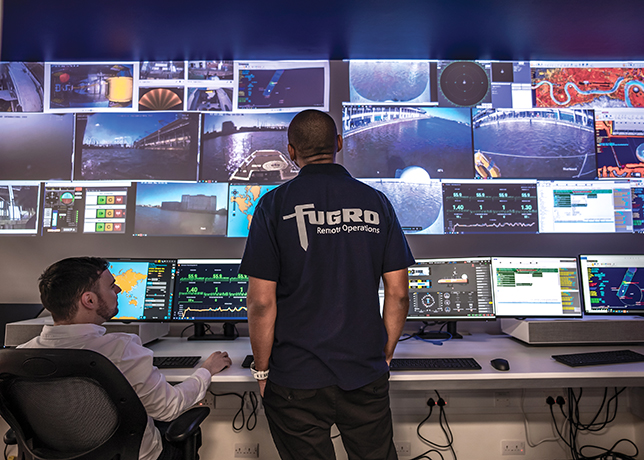
An ROC in Jafza
As regional NOCs push to maximise sustainable production capacities, how is Fugro’s asset integrity and monitoring technology helping operators safely extend the lifecycle of aging subsea infrastructure in the Gulf?
Extending the lifespan of mature fields requires moving from reactive maintenance to risk-based, predictive asset management.
Fugro provides integrated asset monitoring that combines 3D spatial scanning, non-destructive testing, and subsea inspection via ROVs and USVs.
By tracking structural deformation, seabed scour around platform jackets, and soil-structure interaction over time, we provide operators with a continuous, accurate picture of asset health.
This enables NOCs to extend the operational life of critical infrastructure safely and cost-effectively, avoiding unplanned downtime or premature replacement.
To what extent is cloud-based geo-data integration enabling regional operators to build accurate digital twins that accelerate real-time decision-making for complex subsea engineering projects?
Digital twins depend on reliable, connected data.
Offshore energy projects generate large volumes of information, ranging from geotechnical and geophysical data to environmental and operational datasets.
Cloud-based platforms make it possible to integrate these data sources into a single, accessible environment.
This gives project teams a more complete understanding of assets and their surrounding environment.
By connecting data, models and insights, operators can make faster decisions, improve collaboration and respond more effectively to changing project conditions throughout the asset lifecycle.
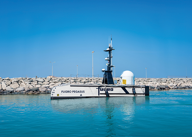
USV - Fugro Pegasus - Working in the Gulf
How does Fugro plan to leverage its specialised marine spatial survey capabilities to support the regional expansion of cross-border subsea power interconnectors and offshore wind feasibility studies in the GCC?
Expanding regional power grids and offshore renewable capacity requires holistic marine spatial planning.
The Arabian Gulf and Red Sea are areas where navigating congested shipping corridors, environmentally protected zones, and complex bathymetric areas are common complexities.
As the GCC invests in grid connectivity and new energy infrastructure, reliable geo-data is becoming increasingly important to identify technically viable, environmentally responsible and commercially efficient project routes.
Fugro provides the foundation for those energy corridors through high-resolution route mapping, geotechnical assessments, and through metocean profiling utilising technologies that range from satellite, to airborne to sea.
Our data ensures that subsea cables and offshore structures are routed safely and engineered to withstand long-term marine dynamics.
With global supply chain pressures impacting offshore logistics, how is Fugro managing vessel deployment schedules and localised equipment maintenance to guarantee uninterrupted project delivery across Middle Eastern waters?
Maintaining reliable project delivery requires a combination of local capability and global expertise.
Fugro has built a strong regional presence with local operational teams, vessel access, equipment hubs and technical support capabilities across the Middle East.
This allows us to respond quickly to changing project requirements while reducing dependence on extended supply chains.
Our ROCs further strengthen resilience by enabling real-time collaboration, remote quality control and faster access to specialist expertise, helping projects remain efficient even in challenging operating environments.
Looking ahead, how does Fugro intend to align its long-term commercial strategy in the Middle East with the UN Decade of Ocean Science to balance heavy energy infrastructure expansion with marine environment protection?
Fugro’s commercial strategy in the Middle East aligns directly with the UN Decade of Ocean Science for Sustainable Development (2021-2030) - where Fugro serves as a key corporate partner - and Saudi Arabia’s Vision 2030 environmental initiatives, including the Saudi Green Initiative (SGI).
We believe that expanding energy capacity and protecting marine ecosystems both require transparent, high-quality ocean science.
By sharing non-sensitive bathymetric and oceanographic data with global public databases like Seabed 2030, we help empower coastal planners, research institutions, and regulators to monitor marine health and build coastal resilience.
Every offshore development we support is grounded in data that protects the marine environment for future generations.