


 GeoStreamer X ... for accurate and efficient lead characterisation
The seismic quality of the data enables excellent well-to-seismic tie with an impressive 80-85 per cent match between the well and the seismic, a First Break paper said
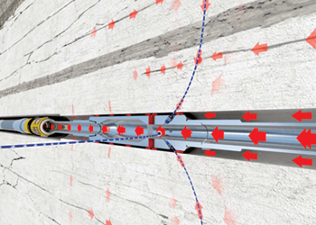
The reliability and accuracy of data from GeoStreamer X, an integrated acquisition and imaging solution by marine geophysics company PGS, has been established in a First Break paper.
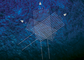
The paper shows how an innovative solution, using multi-azimuth broadband seismic with wide-tow, triple-source shooting has overcome the main exploration challenges in the prolific southern Viking Graben area of Norway.
The area is known for high-quality hydrocarbon reservoirs and complex geology. A number of features are visible that either impede subsurface imaging (for example, shallow channels, rugose chalk) or are challenging targets to image (such as sand injectites).
Late Jurassic rifting led to the formation of numerous horsts and tilted fault blocks along the margins of the Viking Graben. Reservoir targets range from sand injectites, deep marine clastic fans, shallow marine sands, carbonates, to fractured basement.
The GeoStreamer X has delivered high-definition seismic and precise rock properties in the Viking Graben and revealed new nearfield opportunities.
The solution combines multisensor broadband fidelity with multi-azimuth illumination, wide-tow sources and dense streamer spacing for improved near-offset distribution, and long streamers for accurate velocity model building.
This helped accurately map existing fields and known discoveries in the area and have highlighted new leads and opportunities suitable for near-field exploration.
Data acquired has also revealed evidence of additional nearby hydrocarbon potential with improved understanding and characterisation of the various reservoir intervals.
With an integrated approach to acquisition, imaging and reservoir characterisation, encouraging results have been obtained in a very cost-efficient and effective manner.
Several additional wells have been drilled, following the Lille Prinsen discovery, to examine the potential in the deeper stratigraphic intervals such as the Jurassic sandstone and the Permian.
Based on elastic-attributes extraction on the pre-Cretaceous interval, clear indications of hydrocarbons are visible at the Upper Jurassic and Zechstein levels. These anomalies are of reasonable size and could constitute interesting nearfield exploration targets.
RESULTS
The seismic quality of the GeoStreamer X multi-azimuth multisensor data enables excellent well-to-seismic tie in all azimuths and associated angle stack directions. For example, over 10 wells, the average cross-correlation is an impressive 80-85 per cent match between the well and the seismic. The AVO class observed at various reservoir levels in the well has been confirmed with this GeoStreamer X dataset.
Final data from the GeoStreamer X 2020 survey will be available in the summer of 2021.