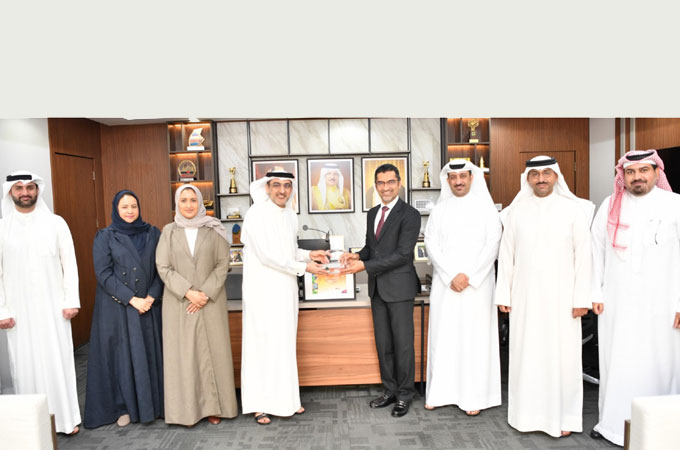
Bahrain's Building Permit Portal ‘Benayat’ has won the international Special Achievement in GIS (SAG) Award in the Government and Production Sector category at the annual Esri User Conference in San Diego, the largest GIS event in the world being organised by Esri, a leading US-based company specialising in Geographic Information Systems.
‘Benayat’ was selected from more than 100 international projects for its innovative features, which distinguished it within its category, said a statement from Information & eGovernment Authority (iGA).
The portal met the award’s standards by demonstrating effective governance, strong leadership practices, forward-looking legislation and policies, and innovative operational processes. It also transformed stakeholder relations by integrating GIS as a core element in both internal and external interactions.
The SAG Awards recognise leading and innovative organizations worldwide in the field of GIS. Nominees must demonstrate outstanding use of Esri technologies in projects that advance GIS development and provide inspiring solutions that can be applied globally, it stated.
The conference brings together tens of thousands of specialists each year, including senior government officials, technology and innovation leaders, and GIS experts from more than 130 countries where the awards are given in the presence of Jack Dangermond - President of Esri.
These awards recognize excellence in GIS Systems and innovation across sectors, focusing on spatial analysis, decision support, and digital transformation.
The government category honours innovative GIS solutions that tackle real-world challenges, inspiring global practitioners to expand geospatial technology use and promote data-driven governance
All the winners belong to sectors such as local governments, public safety, retail, and public services.
Lauding Benayat's achievement, Eng Wael bin Nasser Al Mubarak, the Bahrain's Minister of Municipalities Affairs and Agriculture, said the sheer feat of getting selected from more than 100 global projects highlights efforts to develop Benayat as a pioneering model in the use of GIS.
The system combines effective governance, modern legislation, and innovative operations to streamline building permit procedures, reduce processing times, and strengthen integration among stakeholders in the real estate sector, he stated.
The minister pointed out that Benayat has helped shift the government’s role from operational to supervisory.
By integrating GIS technologies into licensing and planning workflows, it has advanced sustainable urban planning and improved the efficiency of public utility services.
This integration has increased transparency, accuracy, and speed, resulting in higher satisfaction levels among users.
He said the recognition represents a new national milestone for Bahrain, reinforcing the kingdom’s leadership in digital transformation and innovation, showcasing the global competitiveness of national talent, and supporting the Sustainable Development Goals (SDGs) and Bahrain’s Economic Vision 2030.
Commending its achievement, iGA Chief Executive Mohammed Ali Al Qaed said Benayat had streamlined issuing building permits for all projects in record time by integrating it with the Bahrain Spatial Data Infrastructure (BSDI).
The portal also enabled complete digital integration with entities providing key data, including property violations, infrastructure Spatial data and information, and real estate records, he stated.
According to him, Benayat provides more than 15 eServices that simplify the permit process by reducing paperwork, eliminating the need for in-person visits, and cutting processing times by up to 90% with approvals now taking between one and three working days.
Services available through the system include permits for big and small additions, which account for 40% requests.
By streamlining procedures, reducing the number of government entities involved in the approvals by 80% engaging the private sector in reviews, and publishing requirements in a unified guide, the system has accelerated processing and enhanced transparency.
Benayat demonstrated tangible results, including reduced approval times, enhanced digital integration, and improved coordination among real estate entities, which led to higher satisfaction rates among beneficiaries. It also strengthened governance, supported urban planning, and improved the efficiency of utility services by embedding GIS into workflows that allow for real-time tracking, transparency, and efficiency, said iGA in its statement.
It is worth noting that Bahrain received the Special Achievement in GIS (SAG) Award in 2011 from the Environmental Systems Research Institute (ESRI). The very next year the kingdom - represented by the Central Informatics and Communication Organization (CIO), GIS Directorate - was selected among the top two countries globally in the field of GIS by ESRI, it stated.
Additionally, Benayat system was awarded the eGovernment Excellence Award in 2019 under the category of Best Integrated eGovernment Services, and it also won the Bahrain Digital Content Award in 2022, it added.-TradeArabia News Service


