


The offshore industry is at a turning point. As satellite disruptions grow more frequent and unpredictable, navigation resilience has become a strategic and operational imperative
In June 13, 2025, at the height of the 12-day war between Israel and Iran, the Middle East saw one of the most extensive global navigation satellite systems (GNSS) disruptions ever recorded.
Signals were jammed or spoofed far beyond the conflict zones, diverting flights, disorienting ships, and disabling navigation systems.
What began as a military tactic soon revealed how fragile global reliance on satellite navigation has become.
The disruptions didn’t stop with the war. In October, Qatar’s Ministry of Transport suspended maritime navigation due to a 'technical malfunction' in GNSS — proof that interference, once rare, is now routine across the region.
For the offshore industry, where precision drives safety and profitability, these events expose a fundamental weakness.
"The question is no longer whether GNSS can be trusted, but how to operate when it fails. In this new reality, navigation resilience has become an operational imperative," says Emmanuel Sgherri, Sales Director, UAE and ME, Exail.
CIVIL OFFSHORE CHALLENGE: BEYOND MILITARY CONCERNS
GNSS disruptions are often framed as a defence or national security issue, but their impact on civil offshore operations is equally significant.
In oil and gas exploration, offshore wind construction, seabed mapping, and subsea cable installation, precise positioning is not just technical, it underpins safety and efficiency.
When GNSS fails, the effects are immediate: Dynamic positioning systems can malfunction during drilling, risking damage or spills; cable and pipeline laying may halt, causing costly delays; and hydrographic surveys lose accuracy, compromising infrastructure data.
For contractors and vessel operators, this means downtime, project overruns, and greater financial and safety risks.
As GNSS interference grows more frequent and sophisticated, the need for resilient, GNSS-independent navigation has become not a competitive edge, but an industry necessity.
INTEGRATED SYSTEMS FOR GNSS-INDEPENDENT NAVIGATION
For Exail, a leader in navigation and positioning technologies with over 30 years of experience, the answer to GNSS vulnerability lies in rethinking navigation architecture entirely.
Rather than relying on standalone backup systems, Exail advocates for integrated, multi-sensor architectures that combine inertial, acoustic, and advanced data distribution and validation to create a resilient navigation ecosystem.
• Inertial navigation—the foundation of autonomy: At the core of Exail’s approach is the Phins Inertial Navigation System (INS), based on fibre-optic gyroscope (FOG) technology.
Unlike mechanical gyroscopes, Phins provides high-precision heading, roll, and pitch measurements (0.01 degrees RMS) with no moving parts, ensuring stability in harsh offshore conditions.
Operating independently of GNSS, it maintains accurate positioning during signal loss, while its solid-state design minimizes failure risk, a key advantage for offshore operations.
• Sensor fusion—combining strengths for resilience: Exail’s approach to navigation resilience goes beyond inertial systems alone.
True resilience comes from fusing multiple independent sensors to cross-validate positioning data in real time through an integrated architecture combining:
• Doppler Velocity Log (DVL): Through collaborations with leading DVL manufacturers, Exail integrates high-precision velocity data with its Phins INS.
During station-keeping operations, this integration reduces positional drift from around 1,000 m per hour (with INS alone) to just 1.8 m over 10 hours, improving stability and precision by a factor of 5,000.
• Gaps acoustic positioning system: Combining USBL acoustics with embedded inertial sensors, Gaps delivers accurate positioning even under total GNSS denial.
In dynamic positioning operations, its unique inverted USBL mode enables autonomous, high-precision vessel positioning relative to a seabed beacon.
• Netans Data Distribution Unit (DDU): Acting as the system’s 'nervous system', Netans cross-checks inputs from Phins, Gaps, DVLs, and GNSS.
By filtering out spoofed or inconsistent data and switching seamlessly between sensors, it ensures uninterrupted data integrity, the cornerstone of safe and efficient offshore operations.
• Integration, the key to operational continuity and precision: Each element of Exail’s navigation suite adds value on its own, but their true strength lies in seamless integration.
By combining multiple sensors, the system detects and corrects positioning errors in real time, maintaining stable operations despite signal loss or degradation.
When GNSS is compromised, Phins navigates autonomously; when inertial data needs validation, Gaps provides corrections.
Netans safeguards data integrity, forming a resilient framework for demanding offshore conditions. Its modular design also enables easy upgrades as threats evolve, without requiring a complete system overhaul.
• Real-world validation: lessons from the field: Exail’s integrated navigation systems have been proven in demanding offshore operations.
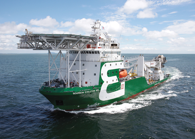
Companies such as Bourbon, DEME, and Jan De Nul rely on them for offshore wind projects, subsea cable installation, and hydrographic surveys.
This capability is built on over 30 years of experience equipping more than 50 navies worldwide, where Exail developed navigation solutions under the highest standards of naval defence.
The expertise gained in military applications now enables civil offshore operators to rely on the same level of precision, reliability, and resilience.
PREPARING FOR A GNSS-DISRUPTED FUTURE
The offshore industry is at a turning point. As satellite disruptions grow more frequent and unpredictable, navigation resilience has become a strategic and operational imperative.
Future operations will be defined not by access to signals, but by the ability to operate confidently without them.
Exail’s integrated approach shows this future in practice. It’s not about replacing GNSS, but about restoring operator control, ensuring operations continue safely, precisely, and autonomously even when signals fail.
In an industry built on precision and trust, resilience is now the key measure of performance.
The silence of satellites marks not the end of navigation, but the start of a smarter, more autonomous era for offshore operations.