


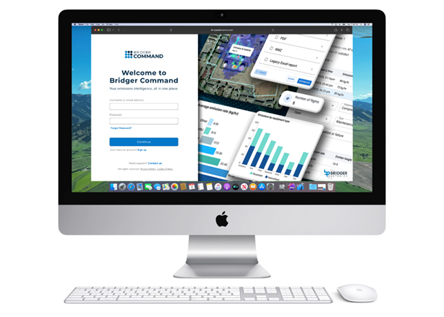


Ubiterra Corporation’s ZoneVu is a cloud-based drilling information management platform that delivers real-time data from the bit, optimising your 3D, and managing your data.
According to a company spokesman: "Real-time data in the cloud means everyone can see the same thing at the same time, anytime from anywhere. Finally, people and processes can keep up with the speed of drilling and volumes of data."
ZoneVu has four layers that integrate and organise geology, geophysics, petrophysics, data management and engineering. These are:
• Administrative: ZoneVu has enterprise capabilities, a multi-business unit hierarchy and a rights-and-roles system to control data and feature access. It allows to enhance and quantify collaboration and accountability with audit logs of user logins and data downloads.
• Data management: ZoneVu hosts a geospatial cataloging and permanent archive for E&P data (well, seismic data, projects, etc) based on the PPDM data model. Folders allow for upload, storage, sharing and retrieval of any type of data. Spatial and keyword search with results displayed on internet maps is as easy as finding restaurants on Google Maps.
• Real-time drilling visualisation and information: ZoneVu’s live browser-based visualisation allows to watch drilling in either 3D seismic or in the well vertical section (actual versus planned). It also allows to see seismic data, faults, interpreted horizons and zone models in real-time. This includes engineering information: ROP, WOB, drilling messages and more. Furthermore, full 3D seismic interpretations can be can uploaded, including SEGY volumes (amplitude and attribute), interpreted horizons and faults.
 |
Next-gen geosteering in a browser |
ZoneVu’s direct connection to WITSML servers captures LWD curve data, engineering WITS curve data, and drilling messages every two minutes. Because ZoneVu is connected to the cloud 24/7, all activity is automatically stored.
• ZoneVu’s patented pending ‘Steering Field’: This is a geosteering interpretation layer that lets users import and utilise one or more type wells per target well. It has multi-block geosteering interpretation that uses LWD-to-Type curve interactive correlations with the ability to make sub-block picks, giving individual blocks structure.
The Steering Field visualises all possible correlations in the full 3D volume so the geosteerer can better assess all the possible interpretations. It automatically updates live drilling information and survey station and LWD data. It also displays the 3D geologic model of zone and faults along with geometrically-correct, updated seismic displays in 3D or 2D, switchable between seismic volumes, thus providing drillers the added ability to analyse 3D seismic attributes versus engineering and LWD data.


